The Water Security Agency (WSA) has provided a new update about spring runoff conditions in Saskatchewan and says the Moose Jaw River should recede soon from its current highs.
Specifically, the river is at peak flow and is expected to fall in the coming days. The water body’s observed flows were similar to 2022, while ice has cleared along the river with only minor jamming.
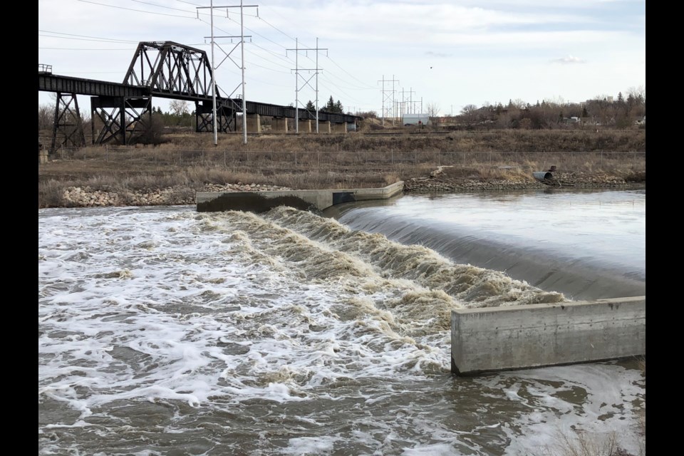
Qu’Appelle River
WSA does not expect to see significant flood effects at this time. All peak levels are likely to be near or slightly higher (up to about 0.3 metres) than those observed in spring 2022.
With rapid snowmelt over much of the Qu’Appelle River Basin last week, many tributaries to the river observed peak flows that were a little higher than what had been expected when WSA issued its April Spring Runoff Forecast.
Significant precipitation is expected over much of the basin this week, with 15-25 centimetres of wet, heavy snow forecasted. Snow is expected to accumulate, but with cooler temperatures expected late in the week, it is expected to melt slower, with significant amounts soaking into the ground.
A slower melt will reduce the amount contributing to streamflow and allow more water to soak into the ground and improve soil moisture conditions.
With the higher tributary flows and snow forecast, WSA is increasing the peak elevation expectations for the Qu’Appelle lakes. Peaks on the mainstem lakes, Pasqua, Echo, Mission, Katepwa, Crooked and Round, should occur late this week or early next.
At this time, no significant impacts due to high water are expected, but ice may pose a risk if strong winds occur during ice break-up on the lakes resulting in ice shoves. Strong winds can push ice onto the shore and against structures causing property damage.
Last Mountain Lake is not expected to peak until late April or even early May.
The control structures at Echo and Crooked lakes have all open operable bays and do not affect upstream water levels. The control structure at Craven is also operating to help manage flows.
Buffalo Pound Lake is near its peak at 510.1 m (0.65 m above typical summer levels). Water in Buffalo Pound Lake will be released into the system slowly to avoid any incremental downstream impacts as conditions allow.
Snowmelt is near complete over lower portions of Wascana Creek Basin but is still in the early stages above the City of Regina, where an above-normal runoff is expected. WSA will likely need to remove stop logs from the Albert Street Weir on Wascana Lake.
Most of the Qu’Appelle River is now ice-free, reducing the risk of ice jams and increasing the river’s ability to move water downstream, reducing the risk of potential flooding.
Old Wives Lake Basin
No communities are believed to be at risk at this time in the Old Wives Lake Basin, but Shamrock Regional Park may experience some localized flooding.
Inflows to Thomson Lake are dropping rapidly, allowing for a reduction in outflows and the reservoir returning below full supply.
A high flows advisory was issued for Notukeu Creek on Saturday. These flows continue to make their way down Notukeu Creek.
Weather
Temperatures are expected to be much cooler through the week with mixed precipitation, rain transitioning to snow, expected from a Colorado Low moving into the province today.
Most of southern Saskatchewan is expected to see some precipitation, with heaviest accumulations likely in the southeast, where upwards of 50 mm is possible.
Snow is expected to have a high moisture content. While some snow is expected to melt on contact, accumulations are likely in the southeast.
Over areas where the snowmelt is largely completed, snow is better than rain as the moisture will be released slowly.
Areas within southeastern Saskatchewan, where the highest snowfall accumulations are expected, may see some localized flooding as this snow melts and enters watercourses. This includes Long Creek, Souris River, Moose Mountain Creek, Antler River, Pipestone Creek and lower portions of the Qu’Appelle River.
WSA reminds the public that flows along water bodies can change rapidly at this time of year and urges the public to take caution.


